|
|
课程介绍
本教程是关于高山摄影探索绝佳视点侦查引导线视频教程,时长:43 分,大小:3.3 GB,MP4高清视频格式,附源文件,共4个章节,语言:英语。
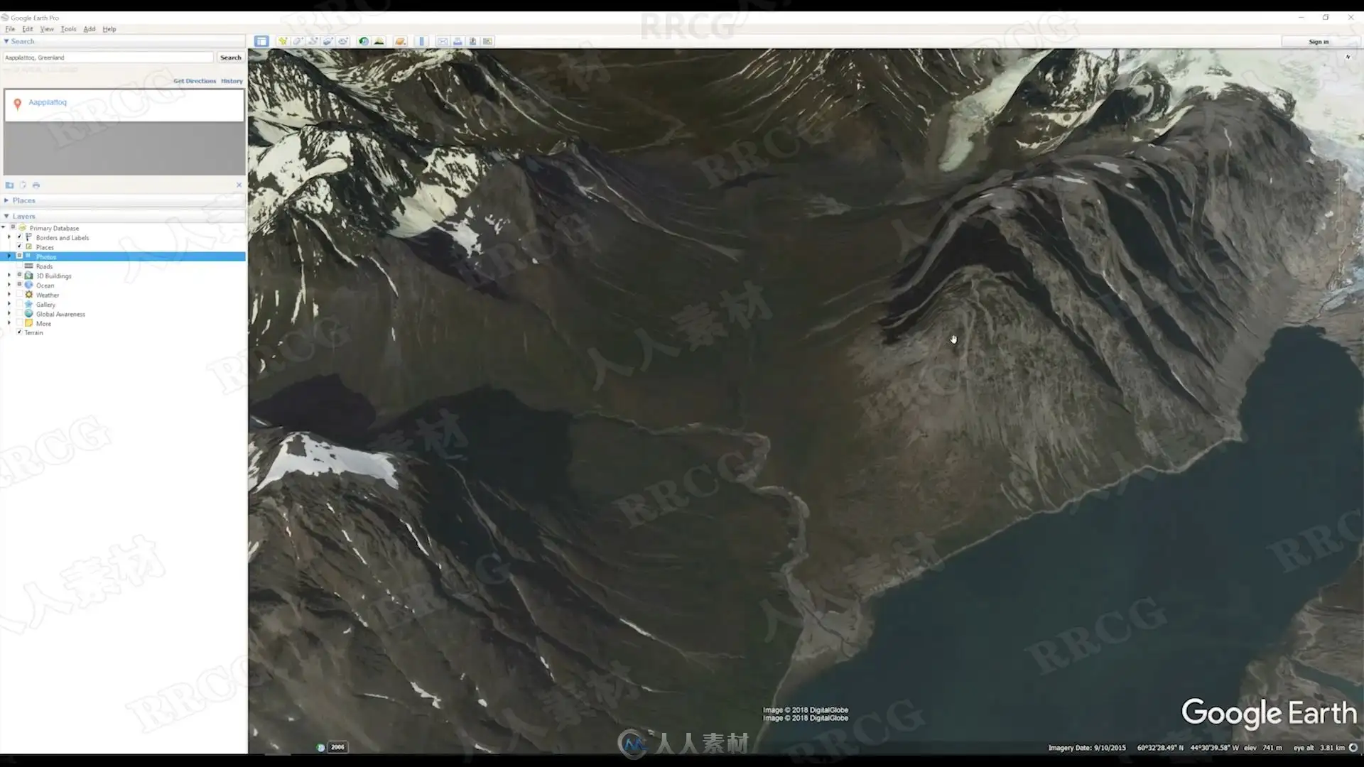
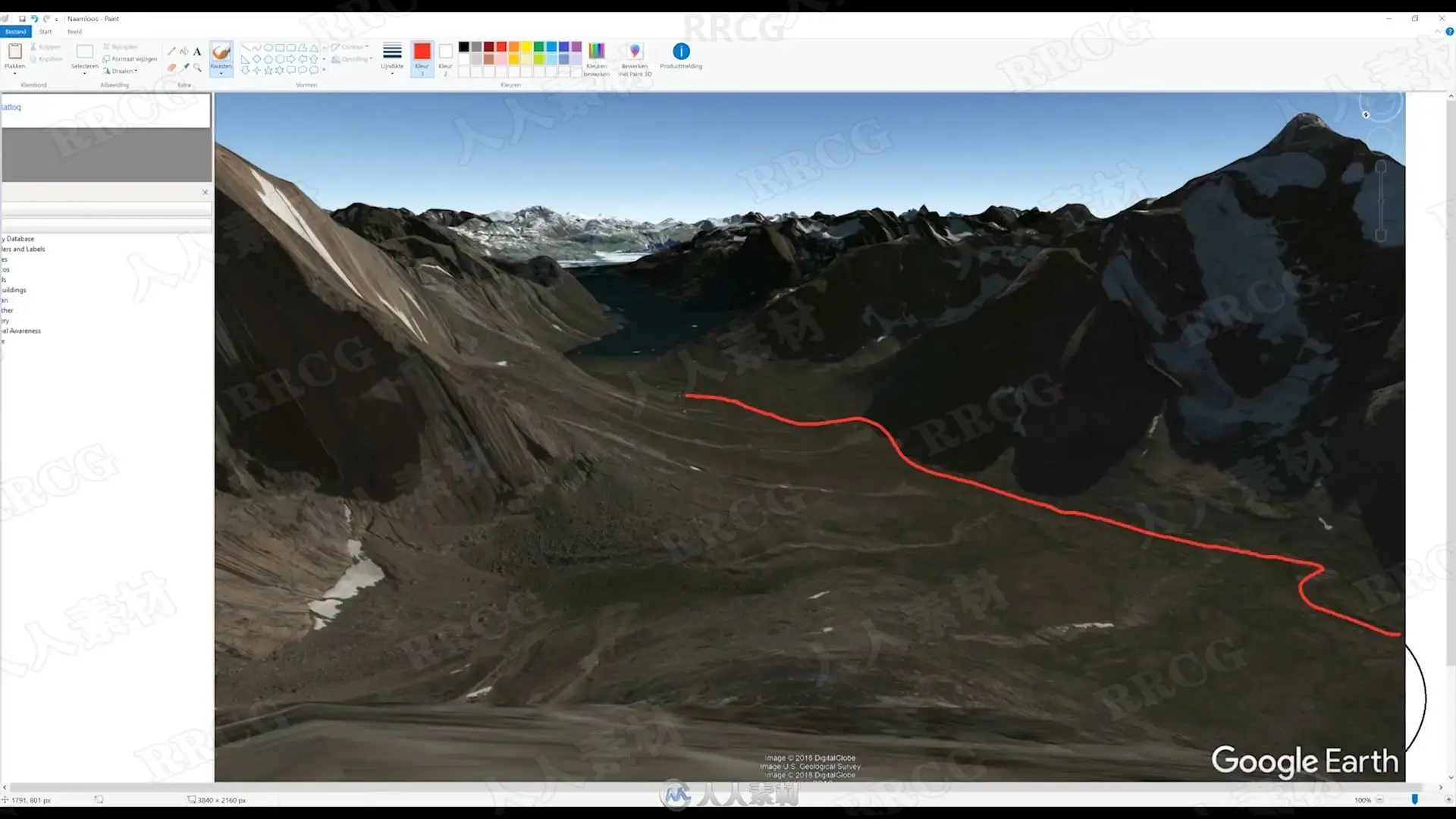
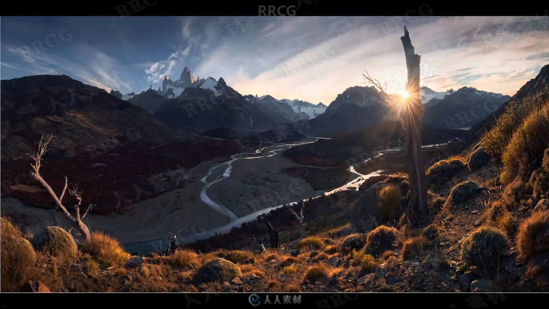
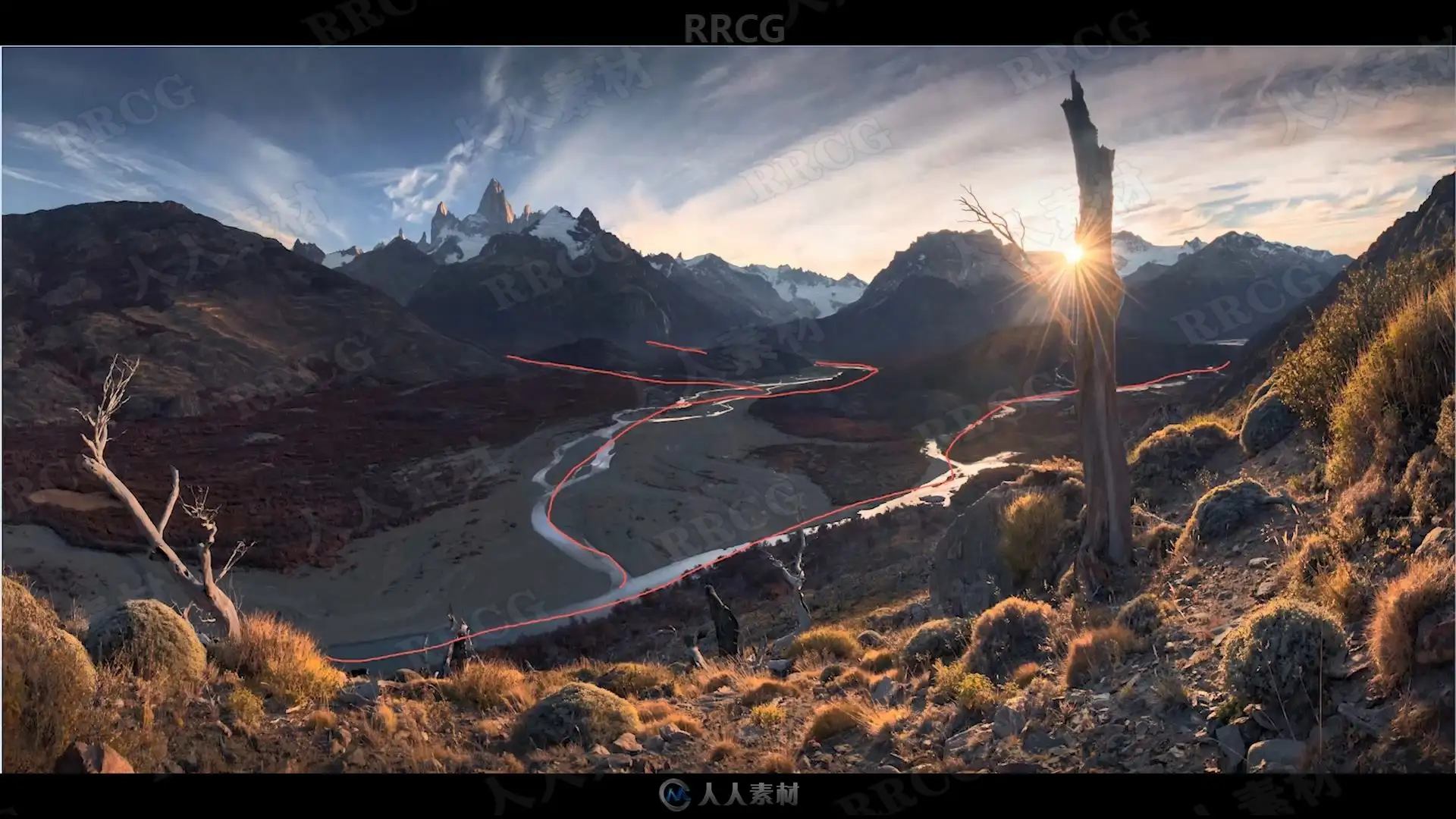
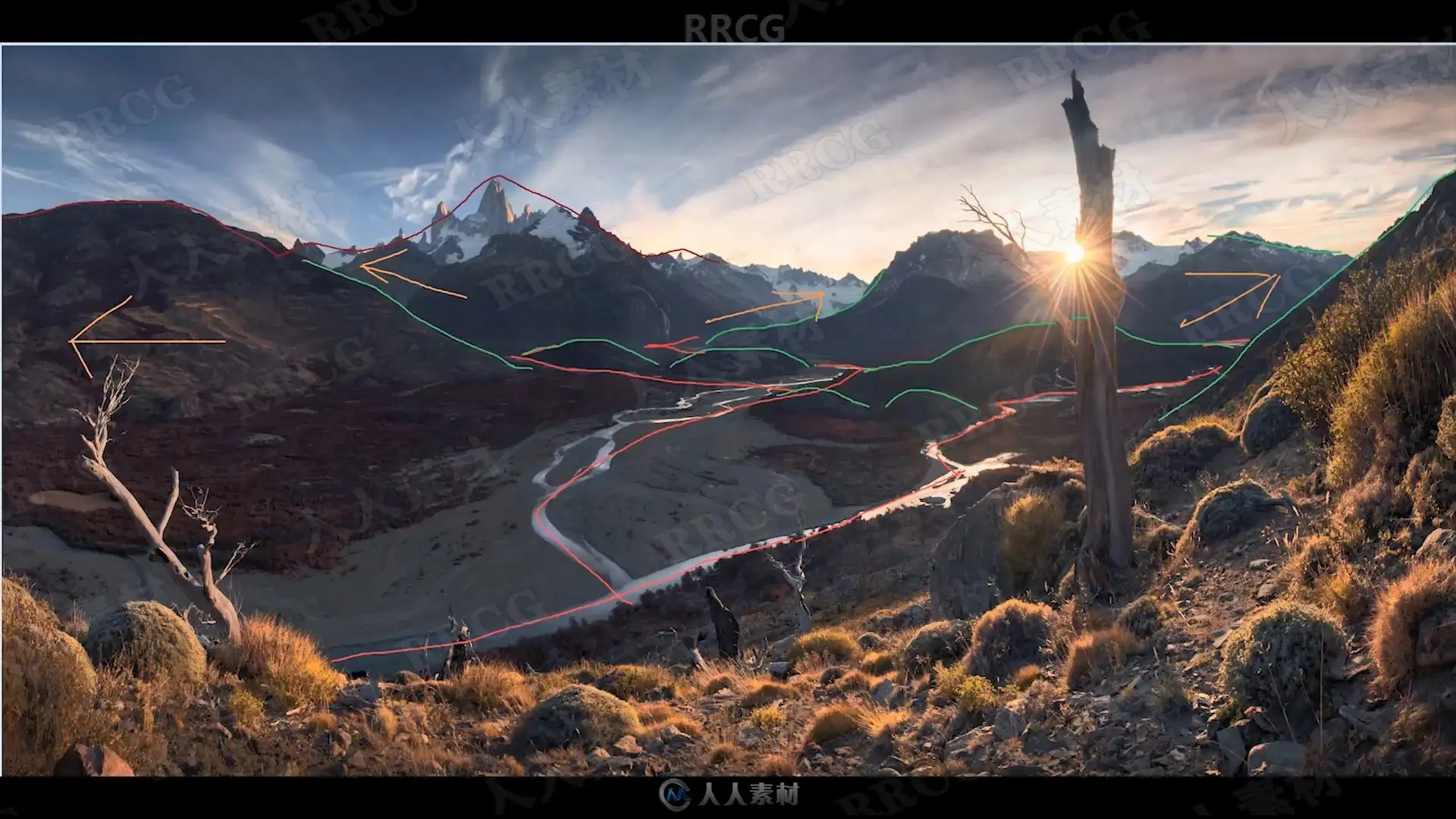
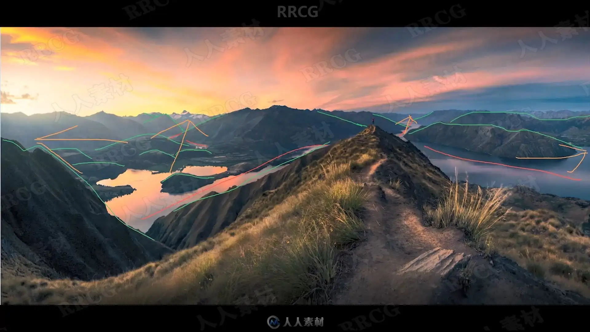
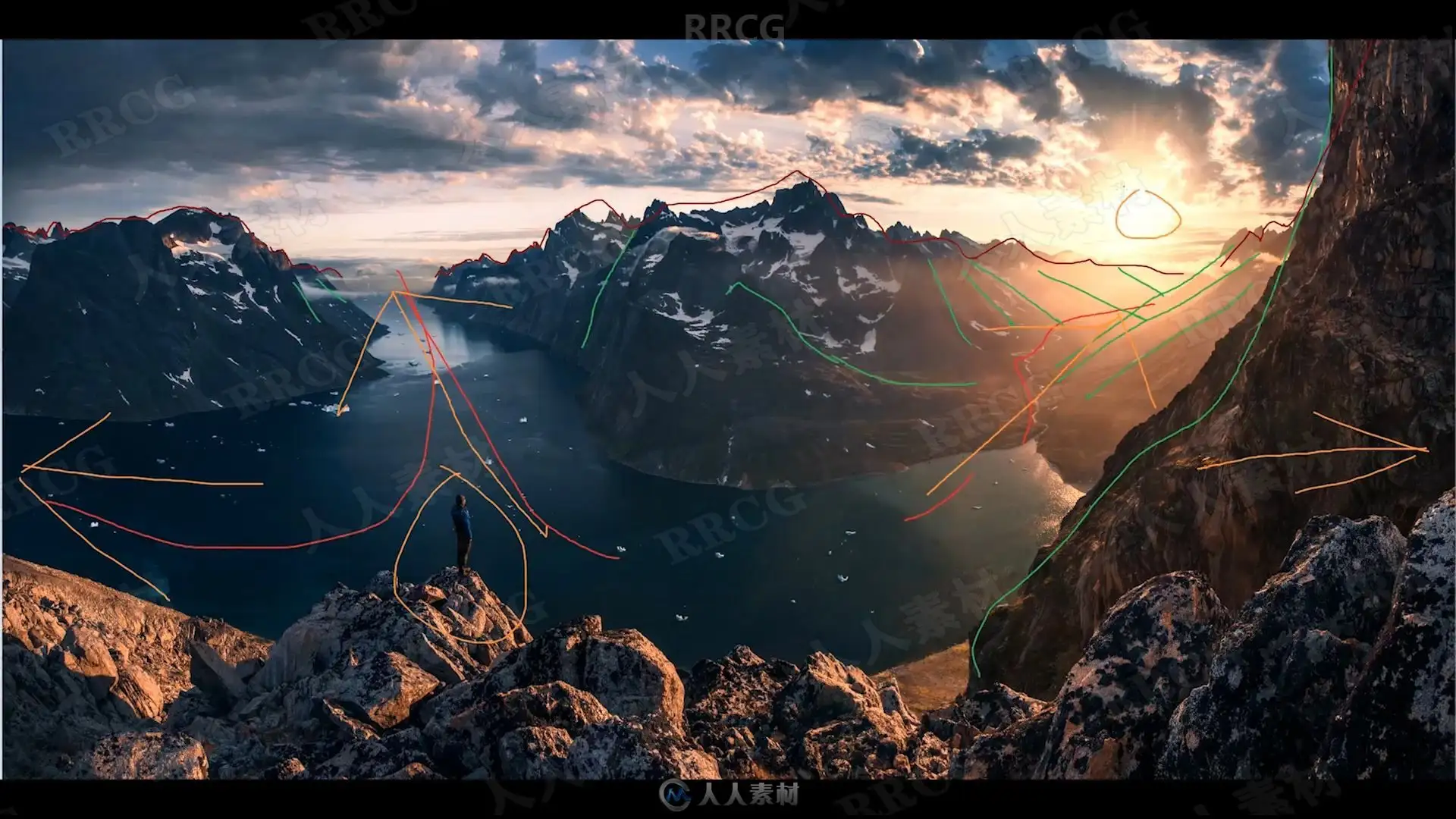
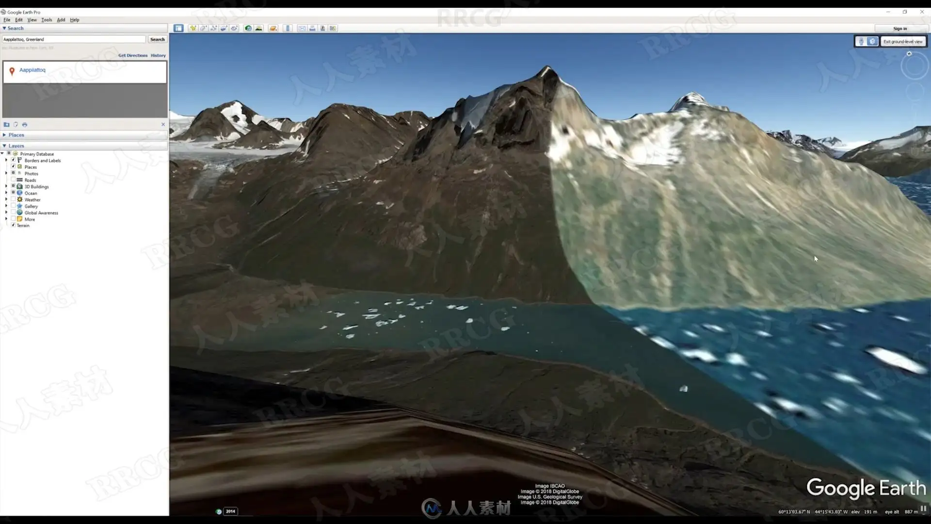
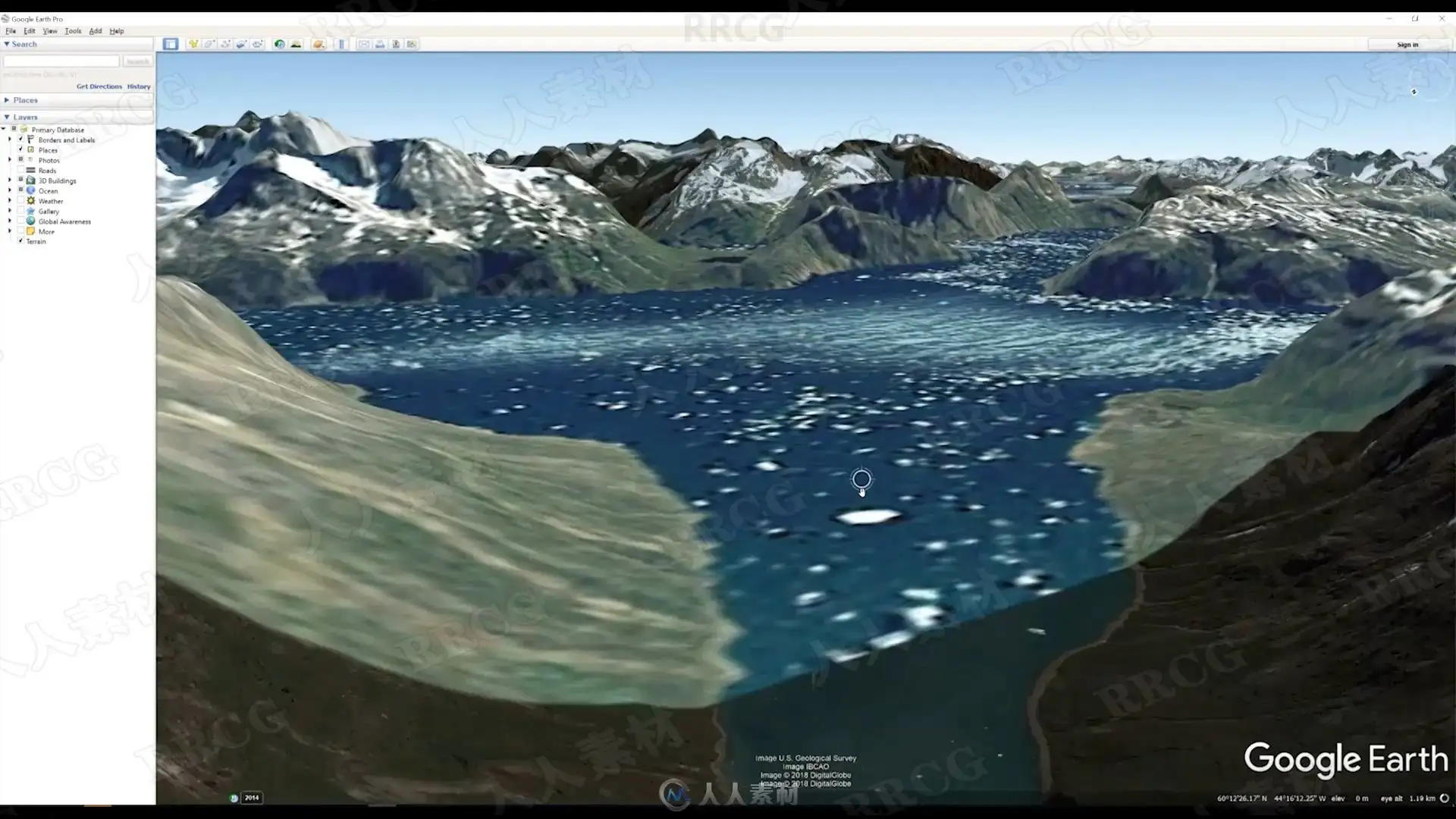
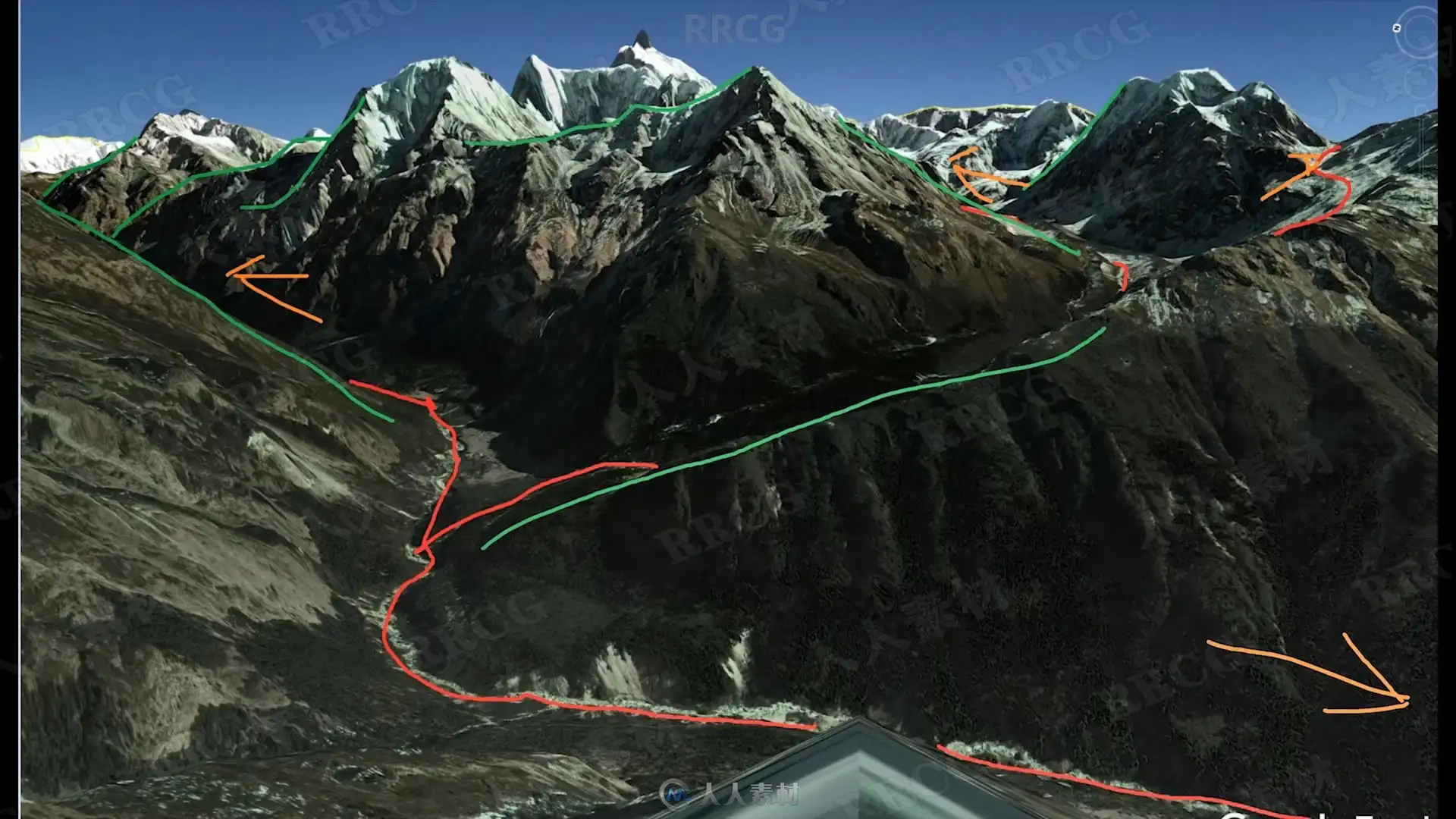
During my ”DIgital Scouting with Google Earth” video I will reveal my secret how I find my award winning locations with Google Earth. Don’t waste time by exploring areas in the field while getting back with often average results. This is normal because it is impossible to find a great viewpoint when standing below in a valley. Instead, use my 5 elements to recognize locations from the highest level with Google Earth. These elements are ”leading lines” (for balance, and direction of the composition) + ”layers” + ”space” (for entry and exit point of the eye) + ”elevation” (mountain contours and river distance) + ”position of the light source”. Not only will I explain and demonstrate my scouting work flow in depth – it will also reveal all my secret locations in South Greenland. These include locations I’ve already shot but also locations I still have to visit – all from the highest level!
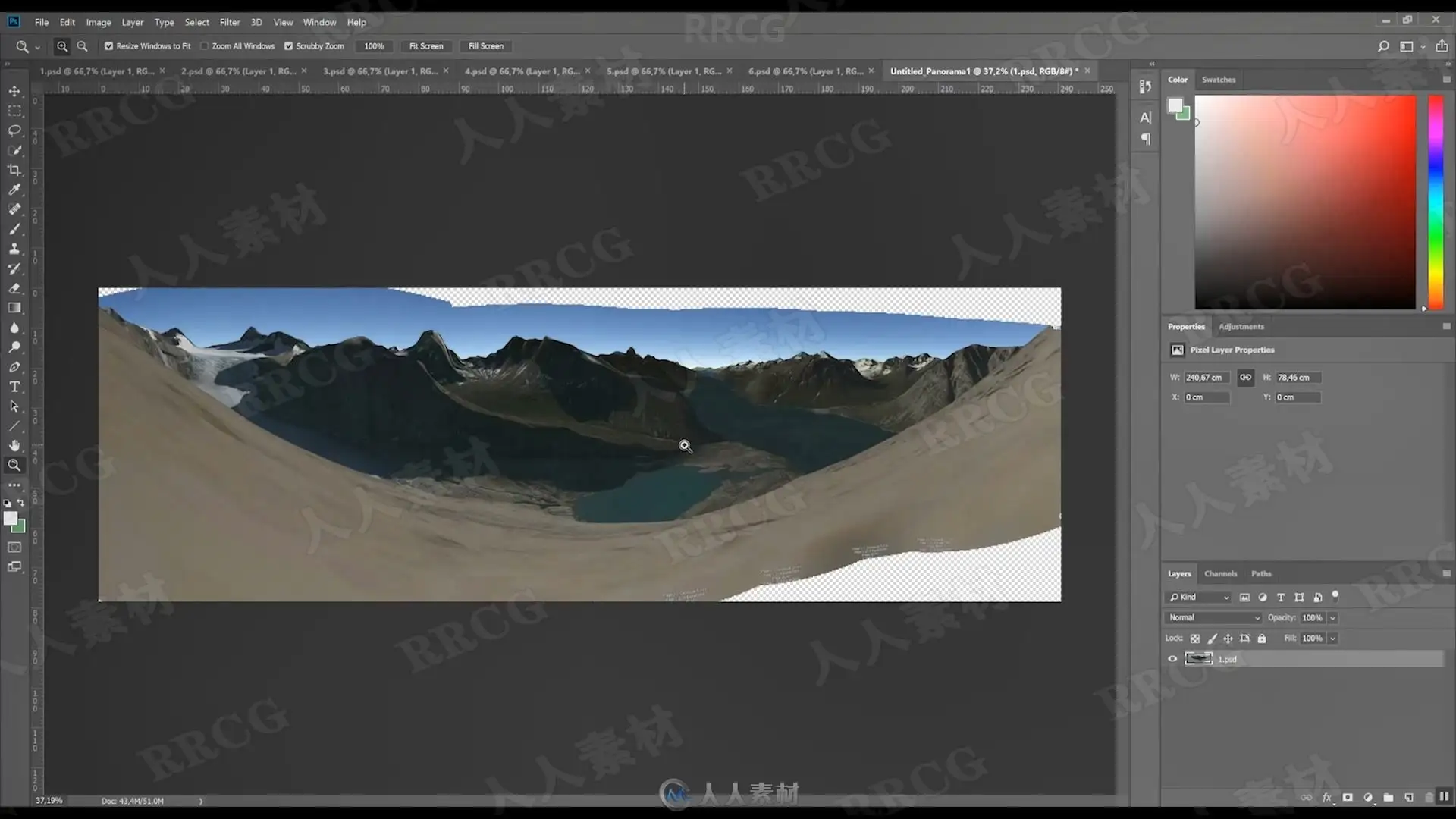
A brand new from Start to Finish from the high mountains of the Andes in Peru. Learn now how to do focus stacking from shots which have been shot without tripod. Not only will I show my latest technique regarding this – I will also demonstrate my latest color perfections techniques – haze and light techniques and the unique contrast control technique. Put your processing to the highest level thanks to this in depth demonstration of unique techniques.
解压密码
|
本帖子中包含更多资源
您需要 登录 才可以下载或查看,没有账号?立即注册
x
本站所有内容均由互联网收集整理、网友上传,并且以计算机技术研究交流为目的,仅供大家参考、学习,请勿用于任何商业目的与商业用途,如需商用请支持正版!如亲下载后改变其用途与使用方式,与本站无任何关系,本站已经进行告知义务!我们只做安全认证测试如果资源侵犯了您的版权利益,请联系站长邮箱:dsymbcom@gmail.com
|